The Pinal County Planning and Zoning Commission reviewed a massive 3,374-acre development proposal during their July 17, 2025 work session that would transform rural land along the Greene Canal into a major energy and data infrastructure hub.
Project Overview and Ownership
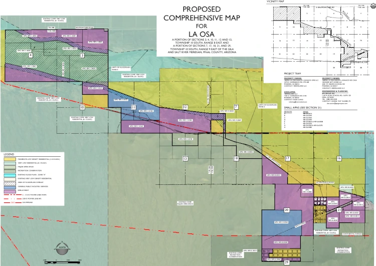
Senior Planner Sangeeta Deokar presented the La Osa Project (PZ-PA-011-25), a major comprehensive plan amendment requested by Vermaland LLC. The project involves two land ownership entities: Verma La Osa Ranch I-10/Sasco 3700 LLC and Verma La Osa Ranch I-10/Sasco Rd Casa Grande 3677 Acres LLC, both using Vermaland LLC as their contact and sharing the same address. Rob Clang from Vermaland LLC serves as the developer and agent, with EPS Group Inc. providing civil engineering and planning services.
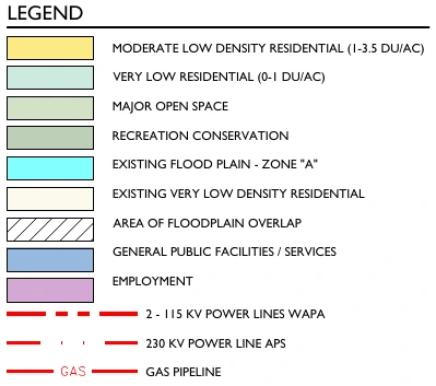
The request seeks to re-designate land from Very Low Density Residential (0-1 dwelling units per acre), Moderate Low Density Residential (1-3.5 dwelling units per acre), and existing open space to Employment, General Public Facilities/Services, and Major Open Space.
Land Use Breakdown
The comprehensive plan amendment would create distinct zones across the property:
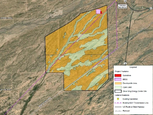
- Employment areas: Approximately 1,910 acres designated for data centers and other employment-generating activities. Project documents indicate battery energy storage systems (BESS) could be incorporated into the development, though specific locations within the land use designations were not detailed in the planning presentation.
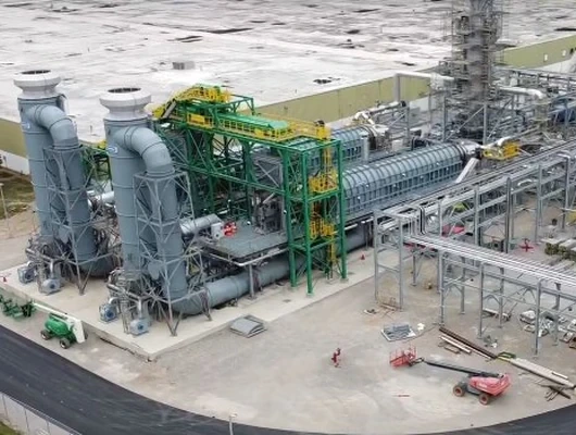
- General Public Facilities/Services: 480 acres designated for gas-fired power generation. According to project planning documents, BESS may also be incorporated into this area.
- Major Open Space preservation: 983 acres of Major Open Space would remain unchanged to preserve the ecological functions of wash systems and wildlife corridors.
The employment designation allows for “a variety of employment-generating business activities such as industrial, office, business park, and warehousing and distribution,” according to the Pinal County Comprehensive Plan.
Location and Surroundings
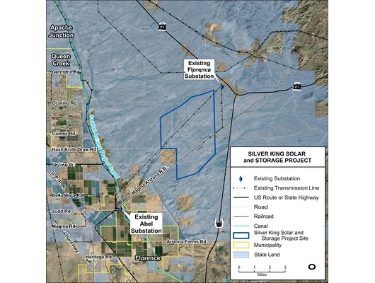
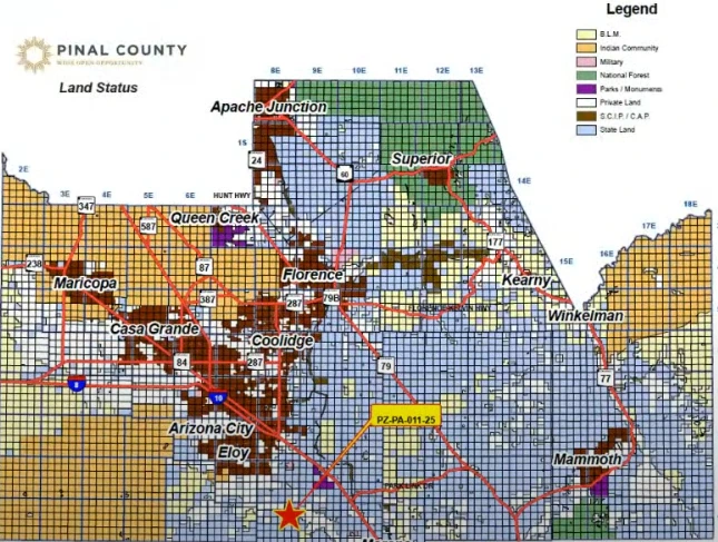
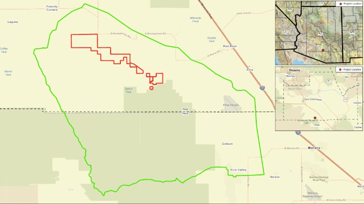
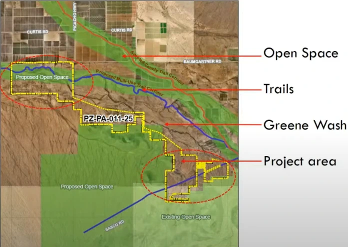
The project is located along the Greene Canal, a channel branching from the Santa Cruz Wash system, in the extended planning boundary south of the City of Eloy. The site spans unincorporated Pinal County land, with state land to the north and south, Bureau of Land Management property to the southeast, and General Rural zoning to the north.
Deokar described the property as having a “ribbon” shape that follows the natural contours of the wash system. The surrounding area consists primarily of undeveloped and agricultural land.
Flood Zone Challenges
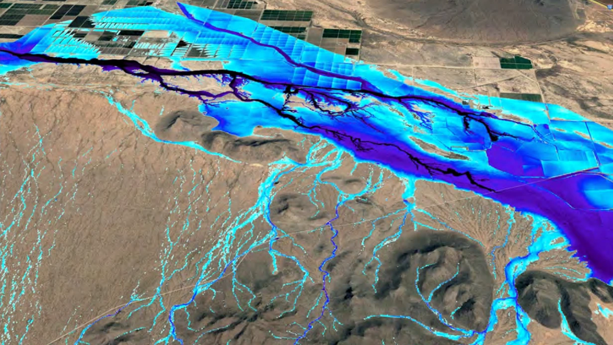
A primary concern in discussion revolved around the extensive flooding risks. Deokar emphasized that “a large portion of the site falls in the major flood zone A,” which indicates a high risk of flooding with a 1% annual chance of flooding, known as the 100-year flood.
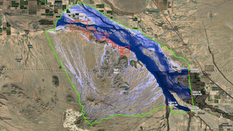

This flood designation places the La Osa Project in a similar situation to the Griffin Energy project, which also chose a flood zone A location near the previously approved Project Bella site.
Zone A represents areas with a high risk of flooding and requires flood insurance for properties with federally backed mortgages. The Pinal County Floodplain Ordinance prohibits “the storage or processing of materials injurious to human, animal, or plant life, if released due to damage from flooding” in regulatory floodplain and erosion hazard zones.
While large portions of the site fall within Zone A, project representatives indicated that all facilities would be elevated above the 100-year flood level and would require floodplain use permits. Energy-related infrastructure—including battery storage systems and gas-fired facilities—would need to demonstrate compliance with these flood protection requirements through floodproofing, elevation, and secure containment to mitigate any risk of hazardous material release.
Proposed Industrial Components
The development would accommodate various industrial and energy facilities. The General Public Facilities/Services areas would house gas-fired power generation facilities, BESS, and associated electrical infrastructure. Employment zones could support data centers, battery storage, and other industrial uses.
The project would require connections to natural gas pipelines, subject to infrastructure availability. All facilities would require elevation above the 100-year flood level and compliance with floodplain use permits.
Environmental Preservation Areas
The Greene Wash and Santa Cruz Wash systems create unique ecological features that require preservation. Deokar explained that these areas provide “water features that support habitat, riparian habitats, wildlife movement corridors” and represent important geological formations.
The project design attempts to work around these sensitive areas by maintaining Major Open Space designations along the washes while utilizing portions outside the direct wash areas for development.
Drainage and Geological Concerns
The site faces multiple environmental challenges beyond flooding. Drainage patterns flow from northwest to southeast, and portions of the project area experience land subsidence, with earth fissures mapped in the broader vicinity north of the project area.
Deokar noted that the project “is subject to flooding and also subject to offsite flows” and would require “detailed hydrological studies” moving forward. Any improvements within the floodplain would necessitate Floodplain Use Permits and potentially require structure elevation and flood-proofing measures.
The Area Drainage Master Plan for Pinal County indicates the property receives approximately 10,000 cubic feet per second of offsite flow from the Casa Grande-Eloy Watershed, particularly the Greene Wash system.
Commissioner Concerns
Several commissioners expressed serious reservations about the project’s feasibility and environmental impact. One commissioner commented that the applicant “must really, really like this area” given the numerous challenges, describing the flood zone and habitat concerns as “stumbling blocks.”
Commissioner Gary Pranzo objected to including energy generating facilities under the General Public Facilities/Services designation, arguing that the land use designation should separately address energy generation rather than group it under general public services.
Commissioner Karen Mooney questioned the logic of developing certain areas that cross directly over wash systems, pointing to a specific section on the map “right where it says in the middle and it says dash 25” that goes “right over the wash” and wondering what could be accomplished there. When Deokar explained that portions shown in green on the county land use map, which represent Major Open Space, would remain undeveloped, she clarified that “at this point, it’s just a land use change,” indicating that the designation doesn’t require building over sensitive wash areas.
Mooney also expressed concern about impacts to wildlife, sensitive wash areas, and increased flooding risk.
Logistical Planning Challenges
Vice-Chairman Robert Klob described the project layout as a potential “logistical nightmare” due to the irregular shape and narrow corridors created by working around flood zones and wash systems. Klob expressed concern about the thin sections of development and the complex “jogs and moves” in the property boundaries.
“We all like big boxes. I get it’s not always possible, but this one’s gonna be fun,” Klob said jokingly, noting that staff would have “their work cut out for them.”
The complex layout results from attempts to preserve wash areas while maximizing developable land, creating what Klob viewed as challenging access and development patterns.
Required Studies and Permits
Future site development will require extensive regulatory approval before moving forward. Developers must provide comprehensive drainage reports for Flood Control District review, environmental analysis through the Arizona Game and Fish Department, and detailed geotechnical studies addressing land subsidence and earth fissure concerns.
All roadway improvements, including paved 28-foot wide public access roads and minimum two permanent access points, require County Engineer approval. The project must also accommodate a planned regional multi-use trail corridor that crosses the northern portion of the property.
The work session represents the initial review phase of this non-voting informational discussion for what commissioners acknowledged would be a complex and challenging development process requiring extensive additional study and regulatory approval.