Key Points
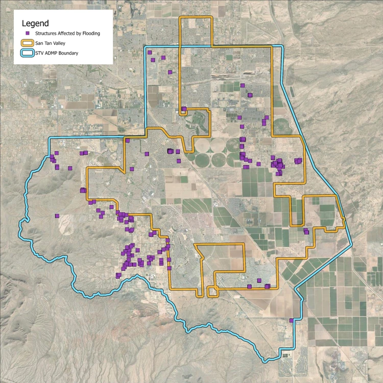
- 222 unique structures face direct flood risk in a 100-year storm.
- The only federally mapped floodplain in San Tan Valley is the Queen Creek Wash.
- Areas with identified drainage issues include Skyline Drive, Morning Sun Farms, Bella Vista, Copper Basin, and Quail Run.
- The county expects to finalize the plan by May 2026 and bring it before the Board of Supervisors for adoption.
- The town can formally adopt the plan — engineers recommended it as a guide for incoming development.
- San Tan Valley’s own drainage ordinance is expected before the council within two months.
- A resident raised concerns about unequal drainage standards between HOA communities and individual lot owners.
SAN TAN VALLEY, AZ — A three-year Pinal County study has identified 222 homes and businesses in San Tan Valley directly at risk from major flooding. Engineers presented the San Tan Valley Area Drainage Master Plan to the Town Council on Wednesday, March 4. The plan maps flood hazards across a 68-square-mile watershed and proposes solutions to protect homes, businesses, and infrastructure.
222 Structures Face Direct Flood Impact
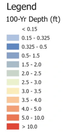
According to the study, in a 100-year storm, up to 222 unique structures face up to six inches of ponding directly against them. Josh Plumb, Pinal County’s Assistant County Engineer, said the term “100-year storm” does not mean the storm occurs once every 100 years. Instead, it represents a 1% annual chance of occurring — meaning it could recur in any given year. Ryan Sauer, lead engineer from Entellus, provided the specific figures: approximately 2.65 inches of rainfall over a 24-hour period, with roughly 2.5 inches falling within a three-hour peak. Smaller storms also cause direct structural flooding. The table below, drawn from the study’s flood hazard assessment, breaks down impacts by storm probability and duration — for example, a “10-year, 6-hour” event refers to a storm with a 1-in-10 annual chance of occurring, lasting six hours.
| Storm Event | Structures Affected |
|---|---|
| 10-Year, 6-Hour | 43 |
| 10-Year, 24-Hour | 66 |
| 100-Year, 6-Hour | 147 |
| 100-Year, 24-Hour | 222 |
| Total Unique Structures | 222 |
Where Flooding Enters San Tan Valley
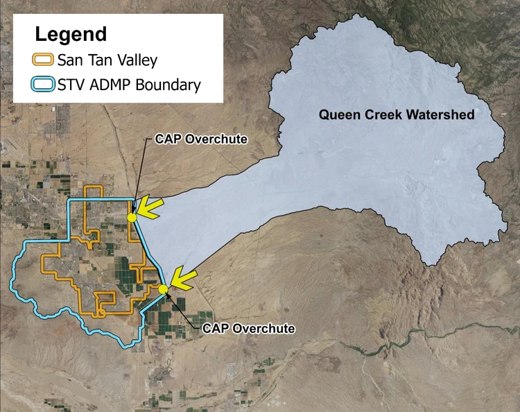
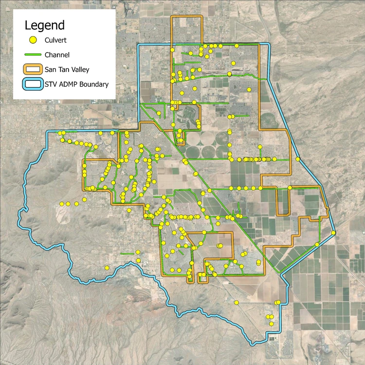
San Tan Valley sits within a complex watershed fed in part by off-site flows from the Queen Creek Watershed, which covers approximately 260 square miles. Sauer described how that water arrives: “There are two locations where that flow enters into the San Tan Valley area. One is the Queen Creek Wash itself, and the other one is to the south there as we point out in the map.”
High-Risk Locations Identified in the Study
Skyline Drive and Ware Farms
Sauer said existing culverts along Skyline Drive are inadequate. Most are filled with sediment. Many have been crushed by vehicles. He said a channel on the south side of the road is too small to convey the flows the model predicts. An informally platted subdivision near Ware Farms shows significant ponding against Schnepf Road in the 100-year model.
Mayor Daren Schnepf said he visited Skyline Drive with Pinal County Supervisor Goodman in October 2025 to assess the flooding. He said Skyline was heavily affected, businesses flooded, and the damage was significant. He told engineers, “I agree with your assessment and your modeling — that needs to be addressed.” The current proposed solution includes small retention basins and storm drains to collect flow from the subdivision, feeding into a larger proposed channel on the north side of Skyline Drive with enlarged culverts to direct water to the east.
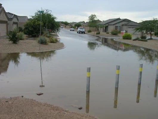
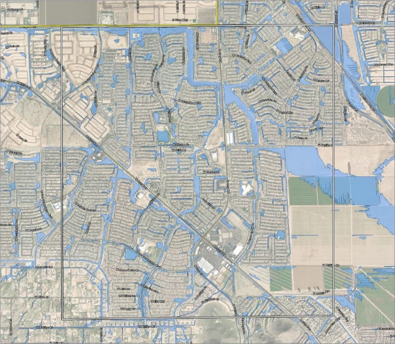
Morning Sun Farms Subdivision
Schnepf also noted that Morning Sun Farms residents were likely watching the study closely, given the drainage issues affecting their community. The study confirmed those concerns. Morning Sun Farms has a large existing channel shown in the image below. However, in a 100-year storm, the model shows water breaking out of that channel and flowing through the neighborhood before returning to the channel. Engineers propose embankment improvements and possibly re-grading of the retention basin, along with other minor improvements, to try to keep flows within existing infrastructure and out of the neighborhood.
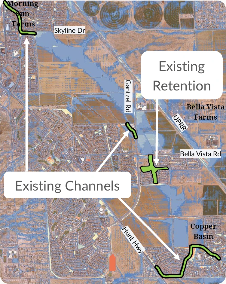
Bella Vista and Copper Basin
The Bella Vista area has an existing retention basin. However, Sauer said a large gap in drainage infrastructure exists between its outlet and the downstream channel. Water currently crosses a large piece of state trust land before reaching the next drainage feature.
The Copper Basin area to the southeast has channels that carry flow to a historically low point. Engineers propose connecting both areas with new channels, culverts, and a large regional retention basin, using existing easements. The system would form one continuous drainage corridor running northward downstream — from Copper Basin through Bella Vista to the existing channel in Morning Sun Farms.
Quail Run Community
Councilmember Gia Jenkins, who lives in the Quail Run area, said her neighborhood floods seriously. She asked what drainage requirements apply when a housing development is built and who bears responsibility for fixing ongoing flooding. Plumb said subdivisions “would have been required to retain their on-site storm water, the 100-year, two-hour storm, as well as addressing any regional flows through there.”
However, he said discontinuity in drainage infrastructure outside subdivisions often creates complications inside them. He added that responsibility for addressing that discontinuity falls to future development or future drainage projects, since original construction likely complied with regulations in effect at the time.
Most San Tan Valley Flooding Has No FEMA Designation
Sauer said the only federally mapped floodplain in San Tan Valley is the Queen Creek Wash itself. All other flood hazards identified in the plan carry no official FEMA designation. To address this, the study produced a 100-year inundation map using two-dimensional hydraulic modeling. It shows where flooding occurs throughout the entire 68-square-mile study area, not only along the Queen Creek Wash.
How the Plan Would Address the Flooding
For identified regional flooding issues, engineers developed solution concepts including culverts, channels, retention basins, storm drains, embankments, drywells, and culvert flap gates. Each proposed solution was modeled to confirm its effectiveness before being included in the plan.
How the Plan Interacts With San Tan Valley Governance
The drainage master plan is a Pinal County document. Plumb said the county expects to finalize it by May 2026. After completion, he said it will go before the Pinal County Board of Supervisors for formal adoption. The county will then identify drainage solutions in unincorporated areas and incorporate them into its five-year and ten-year plans.
The town of San Tan Valley will receive the finalized plan at that time. Plumb said the town has three options: place it on a shelf, incorporate it into planning guidance, or formally adopt it. He recommended adoption and use of the plan as a guide for incoming development. With adoption, Plumb said it would be important for developers to pick up areas of discontinuity and continue regional flows through in a safe, efficient manner.
Town Manager Brent Billingsley told the council that the town is developing its own drainage and flood control ordinance as part of its new municipal code. A draft is currently under review by Pinal County and the Arizona Department of Water Resources. He expects to bring it to the council within approximately two months. Under the proposed ordinance, the town would defer to the Pinal County Flood Control District as its floodplain manager, and permitting for development within floodplain areas would go through Pinal County.
Resident Comment: Equal Drainage Standards for All Properties
During public comments, Karen Mooney — a member of IPAC, the Interim Planning Advisory Committee for San Tan Valley, and a member of the Pinal County Planning and Zoning Commission — raised concerns about unequal drainage standards for HOA communities versus individual single-family lots.
Mooney described a community near Roberts Road, situated at the base of the San Tan Mountains, where water has reached the front doors of homes during flooding. She said HOAs and housing developments are required to follow detailed drainage plans, but individual lot owners are not held to the same standard. She described neighboring landowners who built walls around their properties when flooding began, redirecting water onto adjacent properties.
Mooney said she spoke with Plumb as he was leaving and that the county does not currently have rules for individual lots, though Plumb asked to speak with her further about what may be in the works. She asked the council to consider the issue as a future goal and suggested reaching out to various communities to gather broader drainage concerns. She also noted that the widening of Hunt Highway improved drainage in her area and reduced street flooding on nearby side streets.